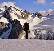
At 9415 ft, Mount Stuart is the second highest non-volcanic peak in Washington. It is also the high point of the Stuart Range, the centerpiece of the Alpine Lakes Wilderness. There are many routes on this complex peak, including the classic West Ridge, and several that involve intense ice and mixed climbing on the north face. I took the standard class 3 route up the Cascadian Couloir, which, including the approach, involves somewhere around 8000 ft of elevation gain in about 12-13 miles, round-trip.
my full trip report is visible on summitpost
http://www.summitpost.org/stuart-solo-via-cascadian-couloir/801778
but, as usual, my photos will be displayed here.
http://www.summitpost.org/stuart-solo-via-cascadian-couloir/801778
but, as usual, my photos will be displayed here.

On the trail up to Longs Pass, what appears to be switchbacks is actually an old road grade the trail mostly avoids.


Longs Pass, the actual trail, not to be confused with my descent route, goes around the larger snowbank to the right.

First full view of Mt Stuart.

Descent from Longs Pass


Longs Pass from near the valley floor.

What is left of the log bridge, crossing next year might be interesting.

Climber's trail up to the Cascadian Couloir.


In the Cascadian Couloir, note the abundance of loose rock.

View back toward Longs Pass.

Finally leaving the couloir.

Sherpa Peak

A steep snowfield that led to the false summit.

First view of the true summit.


The Enchantments from the summit.


The Stuart Glacier, one of three on Mt. Stuart's north face; although not visible in this photo substantial icefall could be heard.

Stuart Lake

The false summit and the route across to the true.


re-entering the Cascadian Couloir.


Mountain goat kids at Longs Pass

Last view of the summit before descending to the Ingalls Way trail.
No comments:
Post a Comment